Sorry, we do not pick-up from AirBnBs or private houses. We only provide pick-up in select hotels in Downtown Whitehorse (Sternwheeler Hotel, Raven Inn, Hyatt Place, Best Western Gold Rush Inn, Edgewater Hotel, Quality Inn).
FAQ
The Aurora Viewing tours at the AuroraCentre are shared with other participants. We have the option to personalize your experience with a private yurt available as a upgrade; however, the bus ride and the facilities are shared.
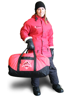
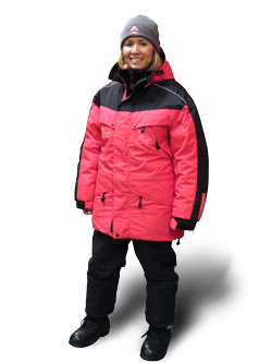
No, the winter rental clothing is an optional paid addition to your package. Please visit our Rental Clothing page for more information.
Three Day - Aurora Weather Forecast
Whitehorse (Canada)


Yukon Climate
| Month | Jan | Feb | Mar | Apr | May | Jun | Jul | Aug | Sep | Oct | Nov | Dec | Year |
|---|---|---|---|---|---|---|---|---|---|---|---|---|---|
| Record high °C (°F) | 10.0 (50) |
11.7 (53.1) |
16.8 (62.2) |
21.8 (71.2) |
34.1 (93.4) |
34.4 (93.9) |
33.2 (91.8) |
31.6 (88.9) |
26.7 (80.1) |
19.3 (66.7) |
13.3 (55.9) |
10.6 (51.1) |
34.4 (93.9) |
| Average high °C (°F) | −11.0 (12.2) |
−7.7 (18.1) |
−0.7 (30.7) |
6.6 (43.9) |
13.5 (56.3) |
19.1 (66.4) |
20.6 (69.1) |
18.5 (65.3) |
12.1 (53.8) |
4.2 (39.6) |
−6.0 (21.2) |
−8.5 (16.7) |
5.1 (41.2) |
| Daily mean °C (°F) | −15.2 (4.6) |
−12.7 (9.1) |
−6.3 (20.7) |
1.0 (33.8) |
7.3 (45.1) |
12.3 (54.1) |
14.3 (57.7) |
12.6 (54.7) |
7.2 (45) |
0.5 (32.9) |
−9.4 (15.1) |
−12.5 (9.5) |
−0.1 (31.8) |
| Average low °C (°F) | −19.2 (−2.6) |
−17.6 (0.3) |
−11.9 (10.6) |
−4.6 (23.7) |
1.0 (33.8) |
5.6 (42.1) |
8.0 (46.4) |
6.7 (44.1) |
2.1 (35.8) |
−3.2 (26.2) |
−12.9 (8.8) |
−16.5 (2.3) |
−5.2 (22.6) |
| Record low °C (°F) | −56.1 (−69) |
−51.1 (−60) |
−42.2 (−44) |
−30.6 (−23.1) |
−12.9 (8.8) |
−6.1 (21) |
−2.2 (28) |
−8.3 (17.1) |
−19.4 (−2.9) |
−31.1 (−24) |
−47.2 (−53) |
−48.3 (−54.9) |
−56.1 (−69) |
| Average mm (inches) | 17.8 (0.701) |
11.8 (0.465) |
10.3 (0.406) |
7.0 (0.276) |
16.3 (0.642) |
32.4 (1.276) |
38.1 (1.5) |
35.8 (1.409) |
33.3 (1.311) |
23.2 (0.913) |
20.1 (0.791) |
16.3 (0.642) |
262.3 (10.327) |
| Average rainfall mm (inches) | 0.3 (0.012) |
0.0 (0) |
0.0 (0) |
1.2 (0.047) |
14.3 (0.563) |
32.4 (1.276) |
38.1 (1.5) |
35.5 (1.398) |
29.0 (1.142) |
8.8 (0.346) |
1.0 (0.039) |
0.4 (0.016) |
160.9 (6.335) |
| Average snowfall cm (inches) | 25.4 (10) |
18.3 (7.2) |
14.8 (5.83) |
7.2 (2.83) |
2.0 (0.79) |
0.0 (0) |
0.0 (0) |
0.3 (0.12) |
4.7 (1.85) |
18.6 (7.32) |
27.0 (10.63) |
23.5 (9.25) |
141.8 (55.83) |
| Average precipitation days (≥ 0.2 mm) | 11.2 | 8.3 | 6.4 | 4.4 | 8.0 | 10.9 | 13.5 | 12.5 | 11.9 | 11.5 | 11.5 | 11.2 | 121.2 |
| Average rainy days (≥ 0.2 mm) | 0.2 | 0.1 | 0.1 | 1.1 | 7.5 | 10.9 | 13.5 | 12.4 | 11.0 | 5.1 | 0.8 | 0.3 | 62.9 |
| Average snowy days (≥ 0.2 cm) | 11.9 | 9.1 | 7.0 | 3.8 | 1.2 | 0.0 | 0.0 | 0.3 | 1.5 | 7.9 | 12.4 | 12.2 | 67.4 |
| Average relative humidity (%) | 72.2 | 64.5 | 51.8 | 42.1 | 38.2 | 39.9 | 46.0 | 47.9 | 54.5 | 64.2 | 75.2 | 74.7 | 55.9 |
| Mean monthly sunshine hours | 43.8 | 105.5 | 163.2 | 238.5 | 251.1 | 266.7 | 247.6 | 226.5 | 132.7 | 84.9 | 39.8 | 26.8 | 1,827.1 |
| Percent possible sunshine | 21.4 | 41.6 | 44.8 | 54.4 | 46.8 | 46.9 | 43.8 | 46.4 | 34.1 | 27.0 | 17.8 | 14.9 | 36.7 |